Aerial view of Manuel Antonio National Park, Costa Rica
From the air, Puntarenas Province, Costa Rica (January 2018)
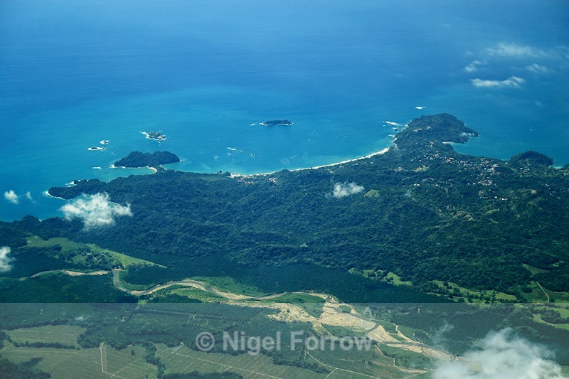
This image was taken during a SANSA Airlines flight from San Jose to Drake Bay (Bahia Drake). It shows Manuel Antonio National Park bordered by the Rio Naranjo (bottom) and Playa Espadilla (top, between Punta Catedral and Punta Quepos). Manuel Antonio town is in the right of the image close to Punta Quepos.
Shooting Time 12:33
Tv(Shutter Speed) 1/800
Av(Aperture Value) 4.0
Exposure Compensation -2/3
ISO Speed 250
Latitude 09 26 19.6 N
Longitude 84 04 18.0 W
Altitude 2069.40m
|
Next (1 of 10)
|
Also in: Costa Rica
 |  |  |  |  |
 |  |  |  |