Laguna Miscanti & mountains beyond, Chile
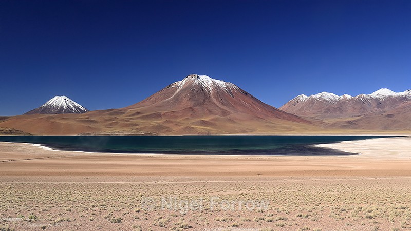
Laguna Miscanti, Los Flamencos National Reserve, south of San Pedro de Atacama, Antofagasta Region, Chile (March 2019)
This image was taken during the North Chile's Coastal & Desert Wildlife trip organised by Natures Images and led by Mark Sisson and Pablo Cersosimo (Wild South Photography).
Laguna Miscanti has a surface elevation of 4140 metres. The mountains in the background are, from left to right, Chiliques volcano (5778 metres), Cerro Miscanti volcano (5662 metres) and Cordon de Puntas Negras (5852 metres at highest point).
Miscanti Lake / Mapcarta
Laguna Miñiques / Mapcarta
Chiliques / Mapcarta
Cerro Miscanti / Mapcarta
Cordón de Puntas Negras / Mapcarta
Shooting Time 17:01
Tv(Shutter Speed) 1/100
Av(Aperture Value) 11
Exposure Compensation 0
ISO Speed 200
Latitude 23 45 9.5 S
Longitude 67 47 24.3 W
Altitude 4154.70m
|
Also in: Chile
 |  |  |  |  |
 |  |  |  |  |
 |  |  |  |  |